


MVCA says lower Ottawa River to ‘exceed minor flood levels’
Special to WC Online
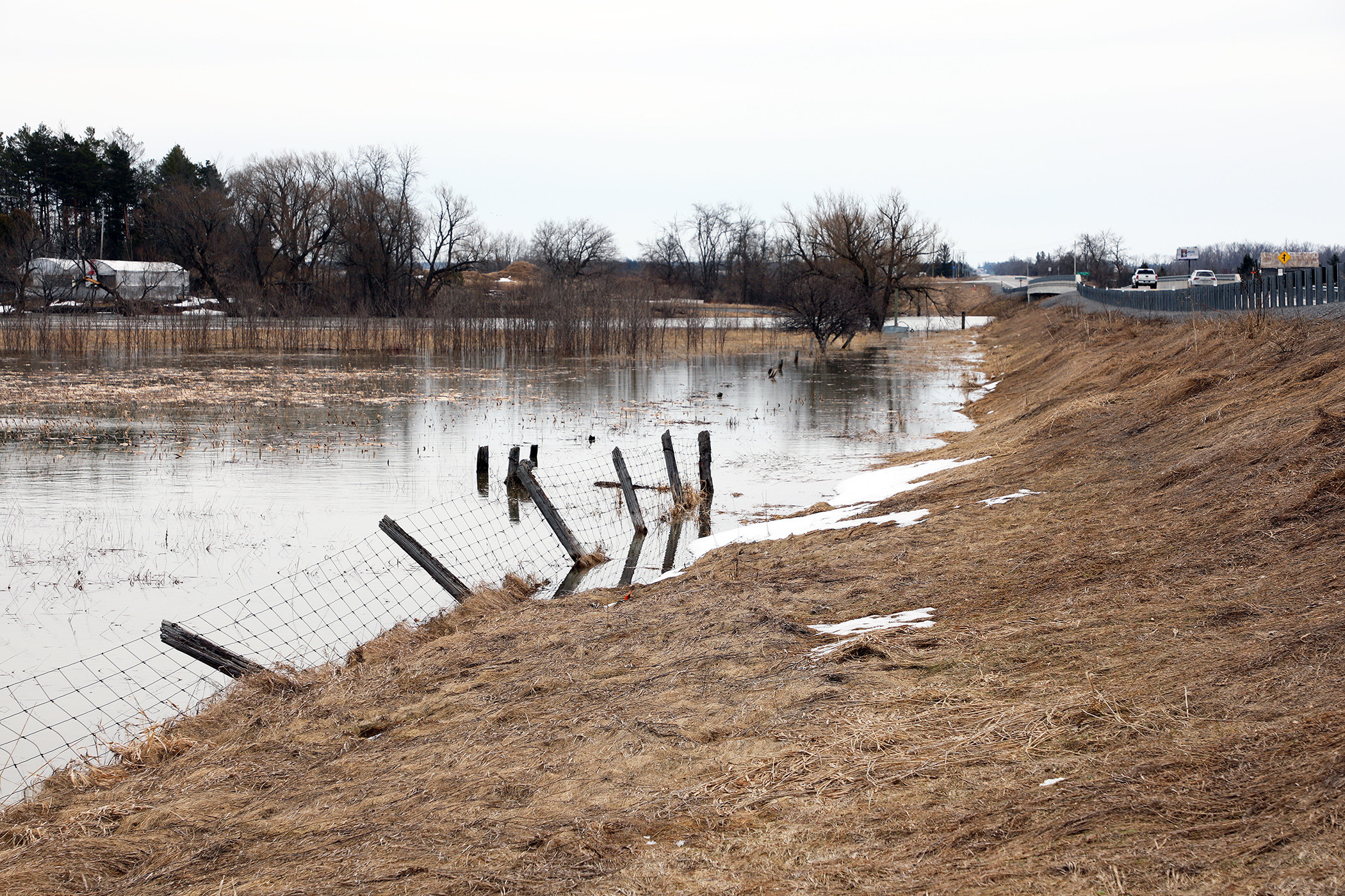
WEST CARLETON – The Mississippi Valley Conservation Authority (MVCA) upgraded the Ottawa River flood status today (April 14) now expecting water levels along the main stem will “exceed minor flood levels.”
“This Flood Watch statement is an update to the Flood Outlook Statement issued for areas along the Lower Ottawa River, Arnprior to Hawkesbury, on April 7,” MVCA water resources technologist released in a statement today (April 14). ‘Due to significant snow melt and forecasted rainfall anticipated on Sunday (April 16) and Monday (April 17), water levels are expected to continue rising within the Ottawa River Basin.”
Most of the water currently entering the Ottawa River is located in areas where there are no reservoirs or retention capacity, North says.
The current strategy by the Ottawa River Regulating Committee (ORRC) is to reduce the amount of water released from the principal reservoirs to prevent water levels exceeding major flood levels.
“The ORRC anticipates water levels along the main stem of the Ottawa River will exceed minor flood levels, impacting several streets and lawns in low-lying areas,” North said.
This includes flood-prone areas at Lake Coulonge, Chats Lake, Britannia/Lac Deschênes, Pointe-Gatineau, Cumberland, City of Clarence-Rockland, Thurso and other vulnerable areas down to Montreal. Areas at greatest risk are located in Cumberland and Rockland.
“While there are currently no major flooding indicators of concern, it is still too early to forecast peak river conditions which remain dependent on snowmelt and rainfall amounts,” North said.
Residents in flood-prone areas are encouraged to closely follow changing conditions and to take necessary measures. Residents are advised to stay away from watercourses where flows are high and where banks might be unstable. Parents are encouraged to explain dangers to children and provide appropriate supervision around all waterbodies.
The Mississippi Valley, Rideau Valley, and South Nation conservation authorities monitor water levels and weather forecasts with the Ministry of Natural Resources and Forestry as part
of the Flood Forecasting and Warning Program. Updates are provided as conditions change.
The ORRC will be reassessing forecast conditions and providing hydrological condition updates on its website daily at www.ottawariver.ca/forecasts. To view current flood warnings across Ontario, visit: www.ontario.ca/law-and-safety/flood-forecasting-and-warning-program.
This Flood Watch Statement is in effect until April 28, at 5 p.m.


Pingback:WCDR leading disaster preparation meeting May 17 – West Carleton Online