Despite receding levels MVCA continues with Ottawa River flood warning
Special to WC Online
WEST CARLETON – Despite Ottawa River levels receding, the Mississippi Valley Conservation Authority (MVCA) issued a continuance of its current flood warning for this week as well.
“This flood warning statement is an update to the flood warning issued for areas along the Lower Ottawa River (Arnprior to Hawkesbury) on April 20,” the MVCA Water Management team released in a statement today (April 27). “Water levels and flows have gradually declined along the Ottawa River over the last few days. Based on forecasts from the Ottawa River Regulation committee, rain forecasted in the Ottawa River basin will lead to increases in water levels starting today. Water level increases should remain below the peaks observed last week.”
From Arnprior to Britannia the potential for major flood levels to be exceeded may be possible by the weekend.
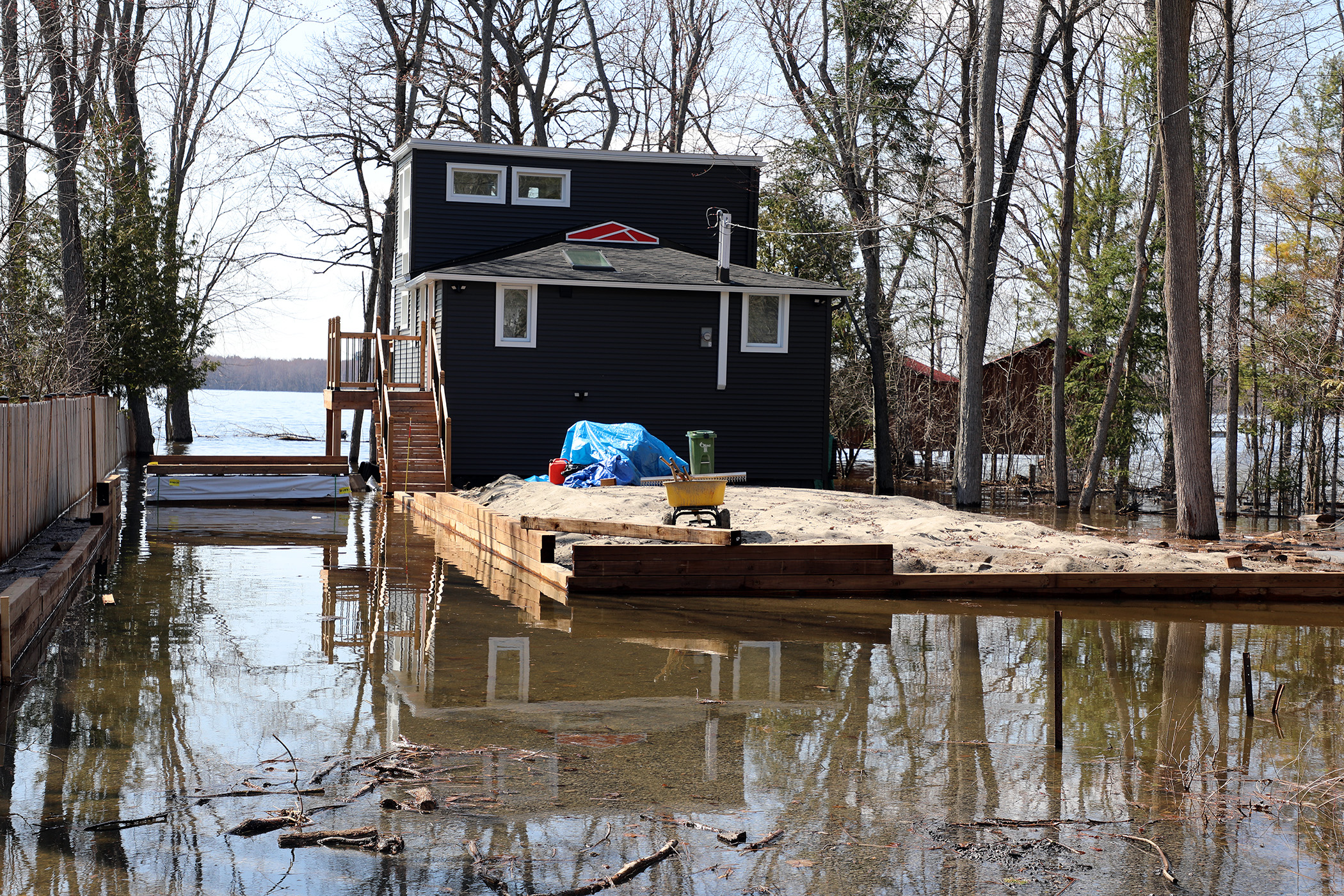
From Britannia to Hawkesbury, minor flood levels are expected to persist in some flood-prone areas, with major flood levels being exceeded in some areas by the weekend.
The minor flood level is defined as the level at which parts of some streets, lawns and parks are beginning to flood, with no or few houses/buildings being affected.
The major flood level is defined as the level at which one or several streets are beginning to flood, with several houses/buildings or neighbourhoods being affected.
“Water levels are currently expected to remain well below historical flood levels on the main stem of the Ottawa River,” the MVCA said.
From Fitzroy Harbour to Shirley’s Bay water levels remain high.
“Water levels in the Constance Bay area have receded from the April 22 peak but remain above the 10-year flood level,” the MVCA said. “Levels are expected to remain elevated over the coming week. Levels may begin to rise again later today and in to the end of the week; however, they are expected to remain below the recent peak. Residents can expect flooding in low-lying and flood prone areas. No impacts to roadway access are anticipated at this time. A small number of low-lying properties will continue to experience water at residential structures.”
From Grandview to Britannia water levels have receded since April 22 and are expected to rise again by the weekend, remaining below the recent peak. Nuisance flooding of low-lying areas, including residential yards and parkland, will persist. Impacts remain largely limited to yard-level encroachment, with no widespread impacts to structures or roadway access anticipated. A small number of low-lying properties may experience water at residential structures. Residents in affected areas should maintain flood mitigation measures.
From Petrie Island to Cumberland water levels have receded since April 22 and are expected to rise again by the weekend, remaining below the recent peak. Flooding of low-lying roadways, parkland, and adjacent properties will persist, with some roads continuing to experience access limitations. A small number of low-lying properties may experience water at residential structures. Residents in affected areas should maintain flood mitigation measures.
Residents in flood-prone areas are encouraged to closely follow changing conditions and to take necessary measures, such as:
- Sump pump is clear, in good working condition and has a backwater valve on it.
- Easy access to portable backup generator and pump.
- Downspouts are clear and the outlet is at least 3 m from the dwelling.
- Driveway culverts are clear of debris and drain well.
- Securing items that might float away as flows increase.
Residents are advised to stay away from watercourses where flows are high and where banks might be unstable. Parents are encouraged to explain dangers to children and provide appropriate supervision around all waterbodies.
The Mississippi Valley, Rideau Valley, and South Nation conservation authorities monitor water levels and weather forecasts with the Ministry of Natural Resources as part of the Flood Forecasting and Warning Program. Updates are provided as conditions change.
The Ottawa River Regulating committee will be reassessing forecast conditions and providing hydrological condition updates on its website daily at https://www.ottawariver.ca/forecasts/.
To view current flood warnings across Ontario, visit: www.ontario.ca/page/floods
Daily water levels and flows are available on the MVCA website at https://www.mvc.on.ca/water-levels.