City’s Public Safety Service gives evening update on flood effort
(Editor’s note: As we did during the 2017 flood, 2018 tornado, 2019 flood and COVID-19 pandemic, we will be making our coverage of potential extreme flooding in 2023 free access to our entire community to hopefully provide flooding updates, important information and resources to all West Carleton and beyond, so those outside the area can better understand what is happening in our rural community)
CITY HALL – The city’s Public Safety Service director Beth Gooding updated council on the flood situation yesterday (April 20) evening as Ottawa’s riverside residents head in to a weekend with lots of rain in the forecast.
“The purpose of this email is to provide you with an update on current conditions, as well as the city’s on-going flood preparedness work,” Gooding, who attended Coun. Clarke Kelly’s flood preparedness meeting April 12, wrote in a memo to council around 8:30 p.m., obtained by West Carleton Online. “The city remains in Enhanced Operations, and activities are being centrally coordinated through the Emergency Operations Centre (EOC).”
The Public Safety Service is part of the city’s Emergency and Protective Services Department.
“The City continues to monitor information from the conservation authorities,” Gooding said. “At this time, flood forecasts remain within the return period for a 10-year event, indicating an onset of flooding slightly beyond ‘normal’ (i.e., one in two-year or one in five-year events).”
Early yesterday (April 19) afternoon, the Ottawa River Regulation Planning Board (ORRB) released the following statement.
“Water levels and flows on the main stem of the Ottawa River are increasing in all locations in response to the rapid melt of the snowpack in the basin,” the ORRB said. “Between Lake Coulonge and the Montreal region, levels are expected to continue increasing today and tomorrow, stabilizing near the major flood level over the next few days. The major flood level is defined as the level at which one or several streets are beginning to flood, with several houses/buildings or neighbourhoods being affected. Water levels are currently expected to remain well below historical flood levels on the main stem of the Ottawa River.”
According to West Carleton Disaster Relief, as of this morning (April 21), the Ottawa River at Constance Bay only rose by about six centimetres to 59.90 m today. The expected peak level has also dropped to 59.99 m. Yesterday’s expected peak was at 60.23 m – a 24-centimetre difference.
“Over the past week, the Ottawa Fire Services (OFS) completed visits to all homes identified as being in higher flood-risk neighbourhoods,” Gooding said of the city’s response. “Specifically, OFS attended residences that would be expected to experience flooding during a one-in-20 year event (i.e., higher than what is currently expected). The visits provided the opportunity to distribute information pamphlets and to connect with residents directly.”
In addition, the city has focused on the following:
Regular surveillance by the Infrastructure and Water Services Department’s Stormwater Management Team of the most recent forecasting provided by the Conservation Authorities, as well as on-site assessments of local conditions by Public Works Department staff in West Carleton, Britannia and Cumberland.
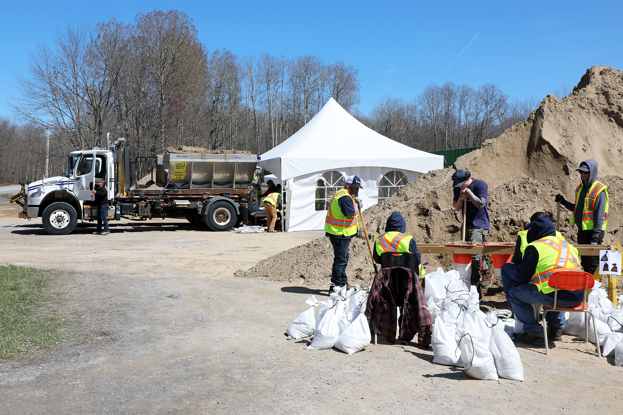
The provision of sand and sandbags at various locations around the city for residents to access. For locations, please visit: ottawa.ca/springflooding.
Sandbag filling operations by staff from the Public Works Department and Recreation, Cultural and Facility Services Department so that filled sandbags can continue to be dropped off in specific neighbourhood locations within low-lying areas more prone to flooding at this time.
Targeted deployments of hand-washing stations and portable toilets, and provision of water for affected residents at three locations in West Carleton that have experienced minor flooding already, impacting residential well systems:
- Sandbagging station at Lighthouse Lane (intersection of Lighthouse Lane and Loggers Way);
- Roadside in front of 167 Moorhead Dr.; and,
- Roadside in front of 22 Moorhead Dr.
“Please note based on current conditions and feedback from residents and members of council, the city will maintain its focus on the above activities over the weekend,” Gooding said.
The WCDR group is organizing volunteer sandbagging initiatives in West Carleton.
“The Infrastructure and Water Services Department is playing a formal role in the city’s EOC,” Gooding said.
Additionally, they have mobilized their Departmental Command Centre to coordinate around three main areas of operational focus:
- Drinking Water to protect the drinking water plants and ensure continuity of operations;
- Wastewater and Stormwater to ensure that the public is protected from basement flooding; and;
- Infrastructure and Asset Management to monitor and respond to potential impacts to city infrastructure, such as roads and culverts.
“At this time, there are no concerns to report, from a critical infrastructure perspective,” Gooding said. “As always, we encourage residents to join the City of Ottawa’s Spring Flood 2023 Facebook group.”
Residents can also visit ottawa.ca/springflooding to get information on current conditions, any road, pathway or park closures, planning and prevention tips, and sandbag depot locations.
“The EOC will continue to monitor conditions, engage with residents and stakeholders, and support preparedness activities,” Gooding said. “We have received valuable input from councillors to date, and look forward to continued collaboration with you.”