


West Carleton now on ‘Flood Warning’ this week
By Jake Davies - West Carleton Online
(Editor’s note: As we did during the 2017 flood, 2018 tornado, 2019 flood and COVID-19 pandemic, we will be making our coverage of potential extreme flooding in 2023 free access to our entire community to hopefully provide flooding updates, important information and resources to all West Carleton and beyond, so those outside the area can better understand what is happening in our rural community)
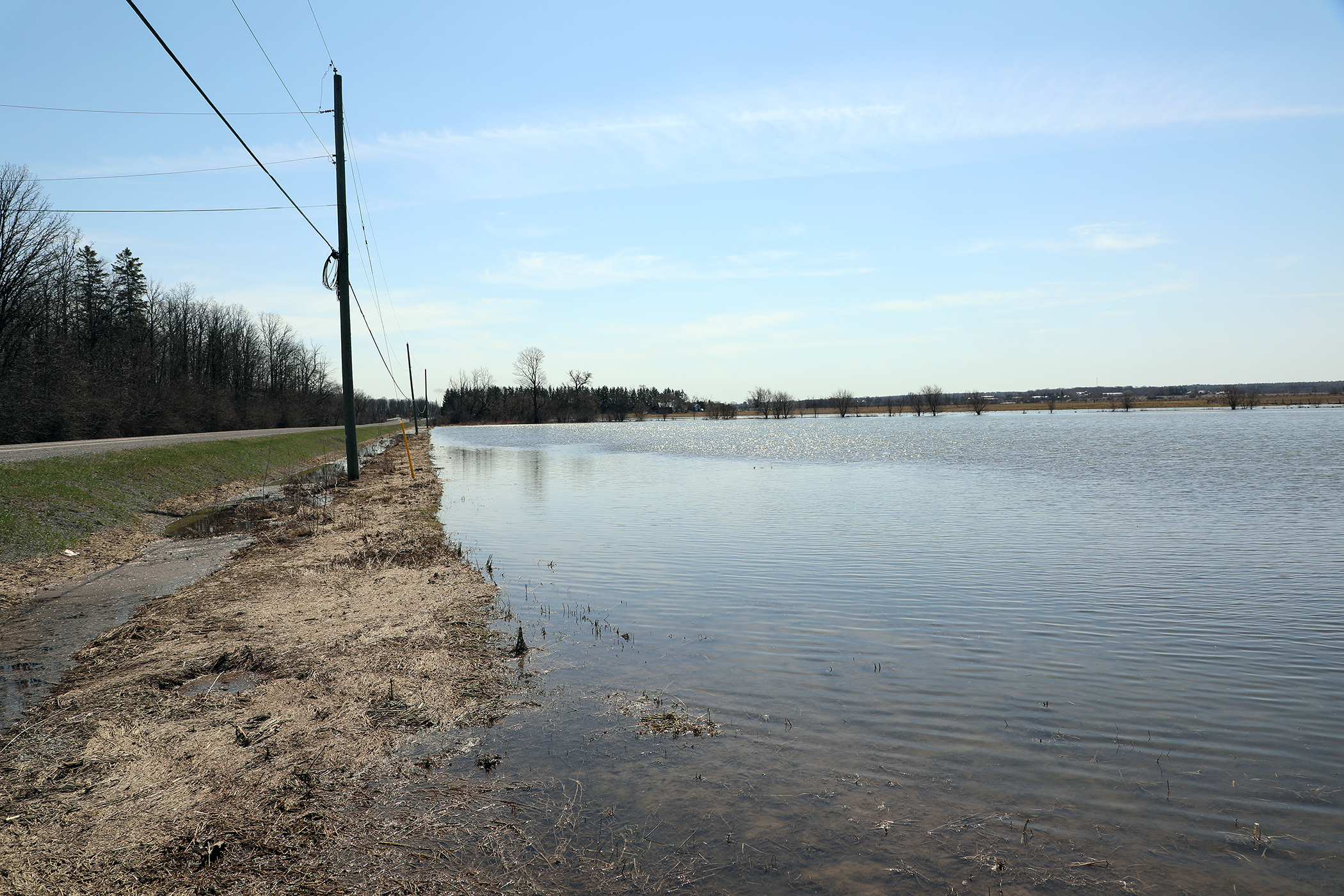
WEST CARLETON – The Mississippi Valley Conservation Authority (MVCA) have upgraded last Friday’s (April 14) flood watch to flood warning status today (April 17) saying low-lying areas in West Carleton should expect flooding by mid-week.
“This Flood Warning statement is an update to the Flood Watch issued for areas along the Lower Ottawa River, Arnprior to Hawkesbury, on April 14,” MVCA water resources Jennifer North released in a statement this afternoon. “Water levels are expected to continue rising within the Ottawa River basin due to increased snowmelt associated with above normal snowpack and high temperatures over the weekend.”
According to the MVCA glossary of terms, a Flood Warning means flooding is imminent or occurring within specific watercourses and municipalities. Most of the water currently entering the Ottawa River is originating in areas where there are no reservoirs or retention capacity.
“The Ottawa River Regulating Committee (ORRC) is managing principal reservoirs to reduce river flows to downstream areas,” North said. “The ORRC anticipates water levels along the main stem of the Ottawa River are expected to exceed major flood levels, impacting several streets, lawns and houses in low-lying areas. Flood levels are expected to remain well below historic high flood levels.”
Impacted locations include flood-prone areas at Chats Lake, Constance Bay area, Britannia/Lac Deschênes, Cumberland, City of Clarence-Rockland, Township of Alfred Plantagenet and other vulnerable areas down to Montreal.
“Water levels in the Constance Bay area are expected to rise by about 0.7 metres above the current elevation as of today (April 17) at 9 a.m., over the next two to three days,” North said.
Water levels in the Britannia area, Grandview Road and the Belltown community, are expected to rise by about 0.65 m above the current elevation over the next two to three days.
Water levels east of Cumberland Village, Boise Village, Morin Road, Leo Lane, are expected to rise by about 1 m above the current elevation over the next two to three days.
Water levels in the Rockland area are expected to rise by about 1 m above the current elevation over the next two to three days.
Water levels in the Hawkesbury area are expected to rise by about 0.50 m above the current elevation over the next two to three days.
“Peak river conditions remain dependent on snowmelt and rainfall amounts,” North said. “A rainfall event is forecasted next weekend that will add water to the river at a time when flows are near flood thresholds. There is uncertainty on the rainfall amounts and the areas that could be affected.”
Residents in flood-prone areas are encouraged to closely follow changing conditions and to take necessary measures. Residents are advised to stay away from watercourses where flows are high and where banks might be unstable. Parents are encouraged to explain dangers to children and provide appropriate supervision around all waterbodies.
The ORRC will be reassessing forecast conditions and providing hydrological condition updates on its website daily at www.ottawariver.ca/forecasts. To view current flood warnings across Ontario, visit: www.ontario.ca/law-and-safety/flood-forecasting-and-warning-program.
This Flood Warning Statement is in effect until April 28, at 5 p.m.
City of Ottawa staff are already preparing for any flooding issues.
“Based on information provided by conservation authorities, including the Ottawa River Regulation Planning Board, the City of Ottawa is expecting flood levels along the Ottawa River to rise above normal levels by Wednesday or Thursday this week,” Ward 5 Coun. Clarke Kelly released in a statement today (April 17). “The flood levels are currently below what residents experienced in the spring of 2017 and 2019. However, residents whose properties and neighbourhoods have experienced flooding in the past 20 years should expect flooding this week.”
Since March, the City of Ottawa has been providing sand and sandbags to residents who live in areas prone to spring flooding at various locations across the city. For an updated list of locations, visit the Spring Flooding 2023 page on ottawa.ca. The city has 527,000 empty sandbags ready.
The city has increased the number of locations sandbag stations are available in West Carleton.
The updated list includes: MacLaren’s Landing at Cottage Lane and Laurentian; Greenland Road at Armitage Avenue; the NorthWind Wireless Fibre Centre in Constance Bay (262 Len Purcell Dr.); Morris Island Drive; Old Quarry Road; Lighthouse Lane and Loggers Way; 2121 Huntley Rd.; 4127 John Shaw Rd.; and 2847 March Rd.
“Residents are advised to take steps to protect their properties if they have not already done so and to check on neighbours for their needs,” Clarke said. “We’d also encourage you to share this information with people whose properties may be impacted.”
Further updates on the city’s response to flooding will be posted on the Spring Flooding 2023 page on ottawa.ca and in the Spring Flood 2023 Facebook group. Concerned residents are encouraged to follow these resources and their local conservation authorities for timely updates.


Pingback:West Carleton’s riverside on high alert – West Carleton Online