


WCDR rallying troops in light of second flood peak
By Jake Davies - West Carleton Online
(Editor’s note: As we did during the 2017 flood, 2018 tornado, 2019 flood and COVID-19 pandemic, we are making our coverage of potential extreme flooding in 2023 free access to our entire community providing flooding updates, on-site coverage, important information and resources to West Carleton and beyond, so those outside the area can better understand what is happing in our rural community)
WEST CARLETON – West Carleton’s volunteer disaster response organization is sending out the rally cry one more time as news the Ottawa River is expected to rise above the April 21 peak by more than 20 centimetres this week.
In the City of Ottawa’s most recent Public Safety Service update, director Beth Gooding says West Carleton leads the city in sandbagged homes, but staff are once again on high alert with the expected high water.
“As expected, water levels have risen at all locations along the main stem of the Ottawa River,” Gooding wrote in a memo to council obtained by West Carleton Online today (May 2). “There has been a significant amount of precipitation over much of the basin, with continued rain in the forecast until Wednesday (April 3).”
Gooding says, the impacts to the city of Ottawa, however, are still relatively small.
“While current water levels have surpassed the peaks observed between April 21-23 and are expected to increase a further 25-35 centimetres (depending on location), they are forecast to remain below historical flood levels. As well, the Ottawa River Regulating Committee (ORRC) estimates water levels are expected to remain 45 to 100 cm below what we saw in 2019 along the main stem of the Ottawa River.”
The Mississippi Valley Conservation Authority (MVCA) released a statement today (May 2) saying the ORRC) is forecasting a 20 cm rise above current conditions in Constance Bay (59.9 metres at 8 p.m. May 1). That depth is expected to reach 60.25 m by Thursday (May 4). The city continues to monitor conditions very closely.
“At this time, we have observed minor impacts to roads and some parks, but nothing impacting critical infrastructure related to flood waters,” Gooding said. “We are encouraging residents, however, to report any issues to 311.”
Gooding says West Carleton leads the way in flood preparation based on what city staff have seen.
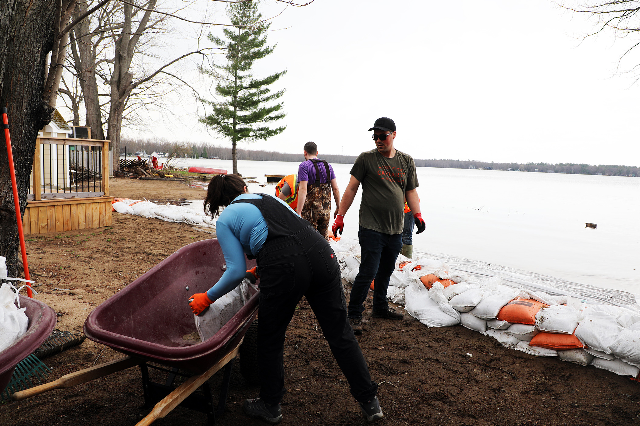
“We estimate that approximately 130 private properties have implemented flood mitigation measures (e.g., sandbags), the majority of which are in West Carleton,” she said. “While there has not been a significant increase in demand for sand and empty sandbags recently, the city continues to make these resources available to residents at multiple locations. Public Works Department staff are also filling some additional sandbags this week, so a small amount of filled sandbags can continue to be available to residents in flood-prone neighbourhoods.”
Gooding says prognosticators are hopeful things will stabilize at the end of the week.
“We anticipate conditions to stabilize somewhat after this weekend,” Gooding said. “The Emergency Operations Centre is working on plans to continue to support residents for the next phase of the flood season.”
In light of the expected increased flood level, last night (May 1), West Carleton Disaster Relief (WCDR) is once again rallying the volunteers to increase sandbag production in the community.
“More sandbagging is needed, and volunteers are essential,” the WCDR released in a statement yesterday (May 1).
Currently sandbags are stockpiles around West Carleton for residents to use.
WCDR has created a live map showing sandbag filling stations in the community and which locations currently have stockpiled pre-made sandbags. The sites with sandbags are marked with yellow icons on this live map you can access here.
Red stars on the map are locations of where volunteers are needed to fill sandbags today (May 2), and include Vydon Acres, Constance Bay and Dunrobin Shores.
“To volunteer sign up here https://bit.ly/WCDRvolunteer or call us at 614-447-4446,” WCDR said. “Registering helps WCDR manage and support our volunteers each day. Please help your neighbours, visit the map above for a direct link to sandbag filling stations where you can volunteer.”
Locations to find filled bags are:
- Baillie and Allbirch
- Baille and Sandbay
- Cul de sac across from 963 Bayview
- 914 Bayview Drive
- 872 Bayview Drive beach access
- Bayview and MacRostie
- Bayview and Lane
- Bayview and Doris Currie
- 620 Bayview Drive beach access
- 708 Bayview Beach access
- Cottage Lane and Laurentian Ave
- Loggers Way and Lighthouse Lane
- Greenland and Armitage
- Crown Point and Opeongo
- Willola Beach Road


Thank you for this excellent coverage of the situation in West Carleton, Jake.