


WC under severe thunderstorm watch, ‘tornado cannot be ruled out’
Special to WC Online
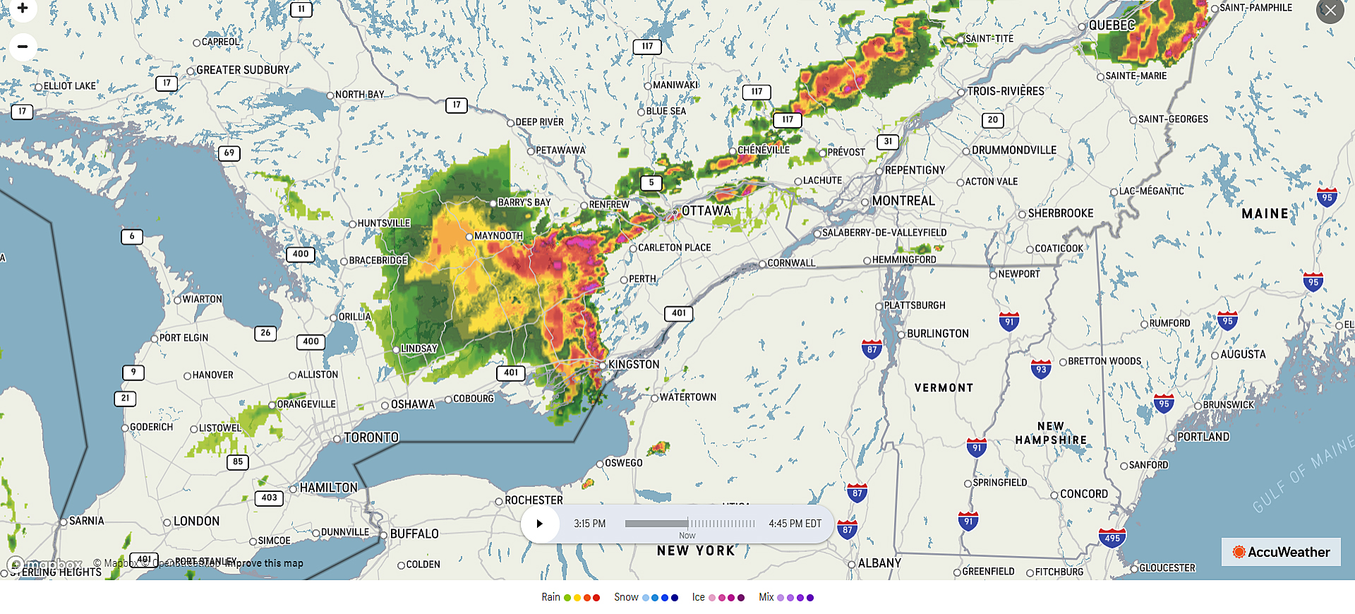
WEST CARLETON – West Carleton is under a Severe Thunderstorm Watch this afternoon (May 21) in to this evening and Environment Canada says “a tornado is possible.”
Environment Canada issued the Severe Thunderstorm Watch around 2 p.m.
“Conditions are favourable for the development of severe thunderstorms that may be capable of producing strong wind gusts and large hail,” Environment Canada released in a statement.
The weather forecasting agency says strong wind gusts up to 120 kilometres per hour and nickel to toonie size hail.
“A tornado is possible,” Environment Canada said. “A line of thunderstorms has developed and is currently over the Peterborough area. These thunderstorms have brought strong winds and hail to the area. A tornado cannot be ruled out.”
Large hail can damage property and cause injury. Strong wind gusts can toss loose objects, damage weak buildings, break branches off trees and overturn large vehicles.
“Extra care and attention should be exercised,” Environment Canada said. “The following localities are included in the warning: Renfrew, Pembroke, Barry’s Bay, Bancroft, Bon Echo Park, Smiths Falls, Lanark and Sharbot Lake. Environment Canada meteorologists are tracking a very dangerous thunderstorm capable of producing destructive wind gusts and up to toonie size hail. Take cover immediately if threatening weather approaches. Intense lightning is likely and tornados are possible with any thunderstorm that develops. Remember, severe thunderstorms can produce tornadoes. Please continue to monitor alerts and forecasts issued by Environment Canada. To report severe weather, send an email to ONstorm@ec.gc.ca or tweet reports using #ONStorm.”
For more information: http://www.emergencymanagementontario.ca/english/beprepared/beprepared.html.


Pingback:Storm topples trees, damages property across WC – West Carleton Online