


MVCA says lower Ottawa River to rise again next week
Special to WC Online
(Editor’s note: As we did during the 2017 flood, 2018 tornado, 2019 flood and COVID-19 pandemic, we are making our coverage of potential extreme flooding in 2023 free access to our entire community providing flooding updates, on-site coverage, important information and resources to West Carleton and beyond, so those outside the area can better understand what is happing in our rural community)
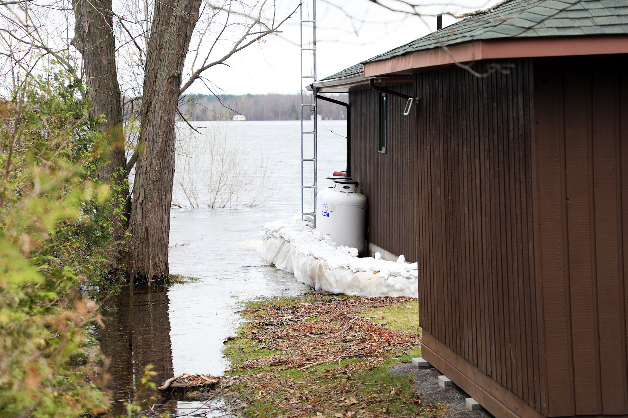
WEST CARLETON – The Mississippi Valley Conservation Authority (MVCA) says West Carleton riverside communities are not out of the woods yet, and is expecting the river to rise next week due to forecasted rain up and down its watershed.
“This Flood Warning Statement is an update to the Flood Warning issued for areas along the Lower Ottawa River, Arnprior to Hawkesbury, on April 20,” MVCA water resources technologist Jennifer North released in a statement today (April 28). “Water levels are expected to rise again within the Ottawa River basin due to significant rainfall forecasted Saturday (April 29) through Tuesday (May 2).”
Forecasters are calling for more than 60 mm between Saturday and Tuesday. Runoff from this rain event will bring additional water volumes to the Ottawa River at a time when levels are already near major flood thresholds.
“The Ottawa River Regulating Committee (ORRC) anticipates water levels along the main stem of the Ottawa River will rise again next week, possibly exceeding major flood thresholds,” North said.
Rainfall runoff could affect multiple streets, lawns and houses in low-lying areas.
“Water levels are currently expected to remain well below historical flood levels of 2019 on the main stem of the Ottawa River,” North said.
Affected locations include flood-prone areas at Chats Lake, Constance Bay area, Britannia/Lac Deschênes, Cumberland, City of Clarence-Rockland, Township of Alfred Plantagenet, and other vulnerable areas down to Montreal.
“Water levels in the Constance Bay area are expected to rise early next week by about 0.3 m above the current elevation,” North said.
Yesterday (April 27) at 4 p.m. water levels at Constance Bay had dipped to 59.90 metres above seal level. The three-day forecast is for it to rise to 59.95 m. The peak in 2017 was 60.44 and the peak in 2019 was 60.75 m. This freshet, the Ottawa River’s high has been roughly 60 m, achieved April 21.
Water levels in the Britannia area (Grandview Road and the Belltown Community) are expected to rise early next week by about 0.3 m above the current elevation, which is about 0.1 m above the highest water level observed this year.
Water levels east of Cumberland Village (Boise Village, Morin Road, Leo Lane) are expected to rise early next week by about 0.45 m above the current elevation, which is about 0.25 m above the highest water level observed this year.
Water levels in the Rockland area are expected to rise early next week by about 0.45 m above the current elevation, which is about 0.25 m above the highest water level observed this year.
Water levels in the Hawkesbury area are expected to rise by about 0.4 m above the current elevation early next week, which is about 0.20 m above the highest water level observed this year.
“Peak river conditions remain dependent on snowmelt in the northern part of the basin and rainfall,” North said. “There is uncertainty on the rainfall amounts and the areas that could be affected. It should be noted that water level forecasts do not account for wind and wave impacts.”
Residents in flood-prone areas are encouraged to closely follow changing conditions and to take necessary measures. Residents are advised to stay away from watercourses where flows are high and where banks might be unstable. Parents are encouraged to explain dangers to children and provide appropriate supervision around all waterbodies.
The Mississippi Valley, Rideau Valley, and South Nation conservation authorities monitor water levels and weather forecasts with the Ministry of Natural Resources and Forestry as part of the Flood Forecasting and Warning Program. Updates are provided as conditions change.
The Ottawa River Regulating Committee will be reassessing forecast conditions and providing hydrological condition updates on its website daily at www.ottawariver.ca/forecasts.
To view current flood warnings across Ontario, visit: www.ontario.ca/law-and-safety/flood-forecasting-and-warning-program.
This Flood Warning Statement is in effect until May 5, at 5 p.m. Updates will be provided as conditions change.


Pingback:Heavy rain this weekend expected to lift river – West Carleton Online