Carp River tributary flood mapping open house March 16
Special to WC Online
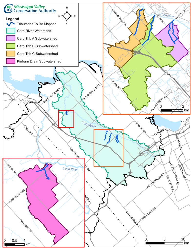
CARP – The West Carleton community will get a look at the work of a combined project between the City of Ottawa and Mississippi Valley Conservation Authority (MVCA) on the Carp River’s major tributaries March 16.
In collaboration with the City of Ottawa, the MVCA is in the process of finalizing regulatory flood and erosion hazard mapping for Carp River tributaries.
As part of that work, the MVCA will host a public information session on Monday, March 16 at the Huntley Community Association Carp Mess Hall (2240 Craig Side Rd.) from 4 to 8 p.m.
Floodplains are low lying areas near a watercourse that are subjected to flooding and unstable slopes due to erosion. In eastern Ontario, the 1:100-year floodplain is the regulatory standard used to identify lands that are vulnerable to flooding. Conservation authorities have been delegated floodplain management responsibilities by the Ontario Ministry of Natural Resources (MNR), achieved primarily through the requisition and administration of accurately engineered floodplain mapping data and documentation.
“With support and cooperation from the City of Ottawa, the MVCA initiated the Carp Tributaries Floodplain Mapping project in the Summer of 2024,” the MVCA released in a statement. “The project studies and maps the flood and erosion hazards along Carp River tributaries in accordance with Section 28 of the Conservation Authorities Act for the identification and mitigation of natural hazards.”
The Carp River tributaries have not been previously mapped, leading to an incomplete understanding of flood risks.
“Developing regulatory floodplain mapping is required to support municipal planning, emergency preparedness, flood forecasting, infrastructure projects, erosion hazards and climate resilience planning,” the MVCA said.
Data collection was conducted through 2024 and 2025.
“Hydrologic and hydraulic models underwent third-party technical peer review in the fall/winter of 2025, and draft regulatory flood and erosion hazard maps are currently being developed,” the MVCA said. “Draft maps will be posted to MVCA’s website in the coming weeks.”
Engineer Juraj Cunderlik was project director and will be at the open house.
At the public open house, community members and stakeholders will be able to review the draft regulatory floodplain maps and talk with MVCA staff regarding any specific or general questions they may have regarding the updated floodplain, the mapping process, and how it will affect them.