Rain causing concern on rapidly changing Ottawa River
By Jake Davies - West Carleton Online
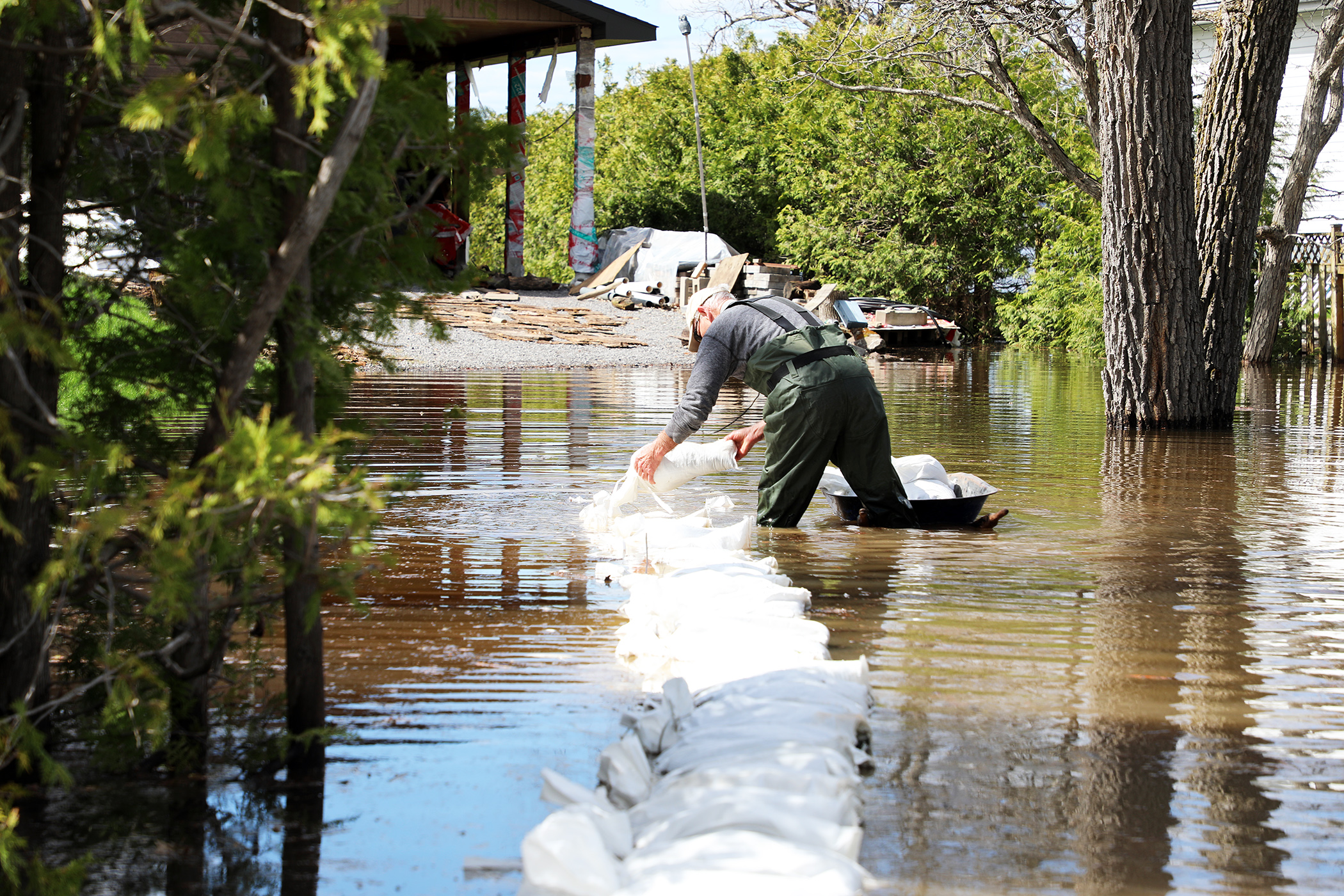
WEST CARLETON – As the community enters an expected rainy day, things are rapidly changing along the Ottawa River with the Mississippi Valley Conservation Authority (MVCA) updating its flood status twice in the same day.
Hours after the MVCA’s first flood watch update, the MVCA updated that status with a much more dire report.
As much as 25 millimetres of rain could fall today (April 26) and combined with the northern melt making its way down the Ottawa River, the MVCA now says the flood watch may exceed major flood levels.
“This flood watch statement is an update to the flood watch statement issued for areas along the Lower Ottawa River, Arnprior to Hawkesbury, on April 25,” MVCA water resources technologist Jennifer North released in a statement yesterday evening (April 25). “The Ottawa River Regulation Planning Board (ORRPB) advises weather events, particularly those bringing warmer temperatures and heavy rainfall, could cause water levels and flows to exceed minor flood thresholds in some areas along the Lower Ottawa River beginning Saturday, April 26.”
Water levels and flows have been gradually increasing along the main stem of the Ottawa River. Levels and flows are expected to increase over the next week due to forecasted rainfall Friday (April 25) into Saturday (April 26), combined with increased spring runoff from snow melt in the northern region of the Ottawa River Basin.
“From Pembroke to Britannia, minor flood levels will likely be exceeded starting Saturday with major flood levels being exceeded in some locations Monday (April 28) to Friday (May 2),” North said. “From Gatineau (Hull Marina) to Hawkesbury, minor flood levels will likely be exceeded starting Monday to Tuesday (April 29), with peak levels likely exceeding minor flood levels Thursday (May 1) to Friday and expected to remain below major flood levels.”
The minor flood level is defined as the level at which parts of some streets, lawns and parks are beginning to flood, with no or few houses/buildings being affected.
The major flood level is defined as the level at which one or several streets are beginning to flood, with several houses/buildings or neighbourhoods being affected.
“Water levels are currently expected to remain well below historical flood levels on the main stem of the Ottawa River,” North said. “This advisory includes flood-prone areas at Lake Coulonge, Chats Lake, Britannia/Lac Deschênes, Pointe-Gatineau, Cumberland, City of Clarence-Rockland, and other vulnerable areas down to Hawkesbury. These results are dependent on the amount of rainfall received.”
Residents in flood-prone areas are encouraged to closely follow changing conditions by consulting the Ottawa River Regulation Planning Board Current Conditions page (https://ottawariver.ca/conditions/) and to take necessary measures.
In a brief discussion at last night’s (April 25) Carp Fair Ladies Night, West Carleton-March Coun. Clarke Kelly told West Carleton Online levels in the area could be similar to the 2023 freshet, but city staff are much better prepared this time around. Kelly says an already planned April 30 community meeting for Constance Bay, could also include a fair amount of information on the current freshet. The meeting will be held from 5:30 to 8 p.m. at the Constance and Buckham’s Bay Community Centre (262 Len Purcell Dr.).
Residents in flood prone or low-lying areas, historically susceptible to flooding, should take the necessary precautions to protect their property. Please ensure:
- Sump pump is clear, in good working condition and has a backwater valve on it.
- Easy access to portable backup generator and pump.
- Downspouts are clear and the outlet is at least 3 m from the dwelling.
- Driveway culverts are clear of debris and drain well.
- Securing items that might float away as flows increase.
Sandbag stations in West Carleton include:
- 262 Len Purcell Drive
- 4127 John Shaw Road
- Lighthouse Lane at Logger’s Way
- Greenland Road dead end at Armitage Avenue
- Moorhead Drive water access
Residents are advised to stay away from watercourses where flows are high and where banks might be unstable. Parents are encouraged to explain dangers to children and provide appropriate supervision around all waterbodies.
The Mississippi Valley, Rideau Valley, and South Nation conservation authorities monitor water levels and weather forecasts with the Ministry of Natural Resources as part of the Flood Forecasting and Warning Program. Updates are provided as conditions change.
The Ottawa River Regulating Committee will be reassessing forecast conditions and providing hydrological condition updates on its website daily at www.ottawariver.ca/forecasts.
To view current flood warnings across Ontario, visit: www.ontario.ca/law-and-safety/flood-forecasting-and-warning-program.
This flood watch statement is in effect until April 28 at 5 p.m.