


C Bay quiet amidst flood concerns
By Jake Davies - West Carleton Online
CONSTANCE BAY – Despite the Mississippi Valley Conservation Authority (MVCA) issuing a flood warning late last week (May 1), a drive through Constance Bay Saturday (May 3) afternoon, including many of the most flood prone areas in the community, seemed downright tranquil.
And that’s a good thing.
West Carleton didn’t receive the expected rain called for by Environment Canada over the weekend, and to the naked eye of West Carleton Online, the Ottawa River levels did not seem to rise anywhere near the expected 25 centimetre jump the MVCA said Constance Bay could experience over the weekend.
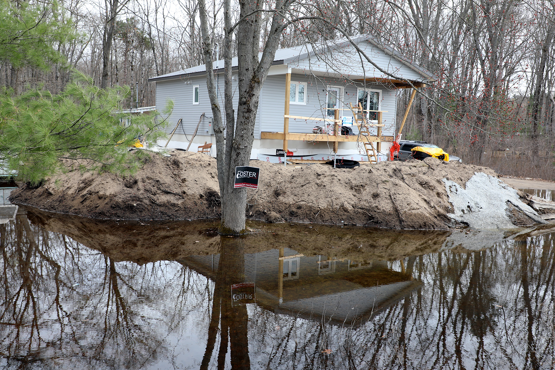
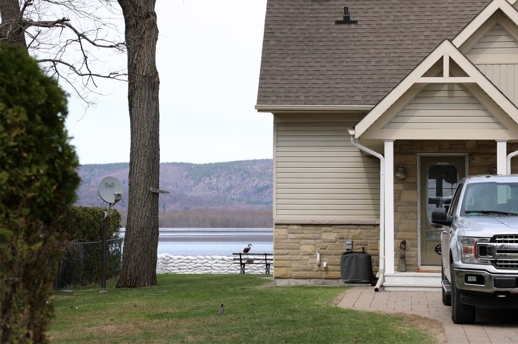
A drive around the entire length of Bayview Drive Saturday, including the hardest hit areas during extreme flooding in 2017, 2019 and 2023, revealed very little evidence of flooding. Piles of sandbags were located at areas along the route, but at the time of the drive, roughly 3:30 p.m., revealed very little activity and limited water pooling on just some of the very lowest levels of land in the community.
We witnessed no sandbagging activity either.
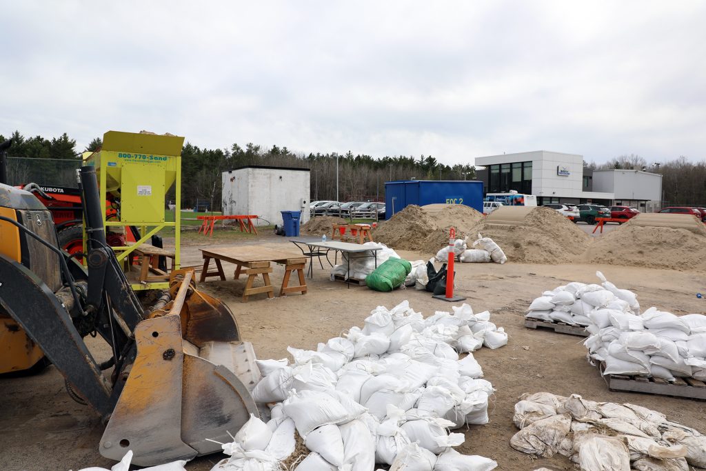
A trip to the Constance and Buckham Bay community centre, the main sandbagging depot for the community, revealed it was fully stocked with bags, sandbagging assists including a machine from Toronto that can fill 1,000 bags per hour, tractors, the West Carleton Disaster Relief (WCDR) emergency trailer and lots and lots of sand, but nearly no one using the equipment.
In fact, there was only one person on site filling sandbags (of course there were families playing in the nearby park and using the facility for other purposes).
West Carleton Online spoke to Dave who had parked his bike and was quietly filling sandbags on the beautiful, sunny Saturday afternoon. Dave did not wish to share his full name or have his photo taken but spoke to West Carleton Online about what brought him out to the sandbag filling depot.
“I’m just doing my part,” Dave told West Carleton Online. “I live out here and I just want to contribute.”
Obviously, being on bike, he would not be transporting sandbags to his own home – he was just filling them and leaving them for the community to help themselves if needed.
“I was out for a bike ride a few days ago, and I saw a few properties were swamped,” Dave said. “They do have lots of sandbags available at a bunch of spots out at the Bay, but I just wanted to come out here and do a few extra in case they are needed. I guess it is better to have them and not need them then the other way around.”
While the sandbag depot was quiet Saturday afternoon, Dave said he has seen it fairly busy other times over the last week.
“That’s okay,” he said. “I’m just doing my thing. I think people are reading the tea leaves a little bit more. They go online and there’s a site that monitors river levels. I think people are sort of keeping an eye on things. My opinion is you never know what’s going to come. We could have a big rainfall or who knows? Tomorrow’s another day, we’ll see what happens.”
Dave and his family have lived in Constance Bay for eight years, so he’s seen the worst of the flooding the community has experienced.
“We usually try to come out and spend a little time here,” Dave said. “Our property is fine, we don’t have any issues, but that’s not really the point. The point is to get out and lend a hand for everybody.”
From his vantage, West Carleton-March Coun. Clarke Kelly recently told a media outlet he is “extraordinarily impressed” with the city’s response so far this year through its Freshet Task Force.
The sandbagging stations have been active for a couple of weeks and more than 20,000 sandbags have already been deployed.
“The city’s annual freshet task force has done a great job of making sure that supplies are there for people should they need them,” he said Friday. “And we continue to monitor the situation and hope they don’t need them.”
The Ottawa River Regulation Planning Board says there continues to be an “increasing flood risk along the Ottawa River.”
“Flows and water levels on the main stem of the Ottawa River continue to rise due to increased runoff from recent rainfall combined with snowmelt from the mountainous areas of the basin,” the ORRPB released in a statement Friday (May 2). “Minor flood levels have been reached in most flood prone locations between Mattawa and Lake Deschenes. Levels may reach or exceed the major flood level in Mattawa and from Lake Coulonge down to Lake Deschenes depending on the speed of snowmelt and precipitation to be received early (this) week.”
From Gatineau (Hull Marina) down to Hawkesbury/Grenville, levels are expected to exceed minor flood levels but should remain below major flood levels. n May 2, peak level estimates are Mattawa (154.65 metres), Pembroke (113 m), Lac Coulonge (108.3 m), Chats Lake (75.3 m), Lake Deschenes (59.95 m), Gatineau -Hull marina (43.8 m) and Thurso (42.40 m).
As of today (May 5), water levels of the Ottawa River at Chats Falls Generating Station sit at 75.27 m with a daily outflow of 3,777 cubic metres per second. The historic high at Chats Falls was 76.28 m on April 29, 2019. The median for this time of year is 74. 5 m.
Below West Carleton at Lake Deschenes at Britannia, water levels are at 59.76 m with a daily outflow of 3,820 cubic m per second.
While we don’t have a lot of data for the Constance Bay area, the 2023 peak was measured at 60.39 and the Constance Bay gauge was not operational before 2023. WCDR’s current estimate is the water level through Constance Bay will peak at 60 m.
“Flooding is not expected to reach 2023 levels; some properties will still be affected,” WCDR released in a statement. “We realize that early predictions not always reliable and the City of Ottawa Public Works Department have mobilized additional resources to help protect our communities. Please email us at flood@westcarletonrelief.ca if you need help understanding your risk.”
Environment Canada is calling for a chance of showers every day from today through to Thursday (May 8) this week.
For a map of sandbag locations in West Carleton, click here.


